
: Cliff Mass Weather Blog This blog provides updated forecasts and comments on current weather or other topics Tuesday , September 10, 2013 The Banana Belt Ripens One of my favorite local anomalies is the Brooking's , Oregon hot spot and the cool temperatures that are inevitably a few miles away . nbsp Brookings is a coastal town just north of the Oregon CA border that is famous for occasionally enjoying wacky warm temperatures . nbsp It is known as the Oregon coast's banana belt Today , Brooking , Oregon got to 100 or 101, depending on which station you looked at , while just offshore temperatures were in the mid-50s see map A few files south of the border , upper 60s and mid-70s were the rule . nbsp But even there , a few miles inland temps can to 104F These amazing hot temperatures were

 It is with great sadness this morning that we have learned three well known and highly respected storm chasers have lost their lives while chasing near El Reno, Oklahoma on Friday. Tim Samaras and his son Paul, and Carl Young were killed by the wedge tornado that occurred on Friday.
 Tour 2 intercepts tornadoes near Granbury, Texas
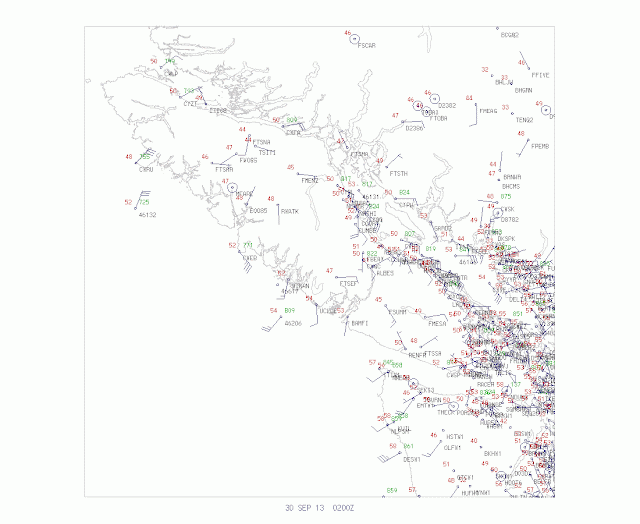 : . Cliff Mass Weather Blog This blog provides updated forecasts and comments on current weather or other topics Sunday , September 29, 2013 And now the winds . Just a brief note . The better models GFS and European Center were right . the intense low center is making landfall on central Vancouver Island , sparing the Puget Sound region a major . windstorm Here are some marvelous satellite images a few minutes old . one an infrared image and the other a water vapor image . nbsp . Extraordinary The latest surface plots clearly show the circulation on Vancouver Island . nbsp Looks like a roughly 970 hPa . low The coastal radar has been very helpful , showing that the circulation was not approaching the WA . coast As the low moves inland and north of us , the north south pressure differences
 Clouds sure increased fast today and it helped temperature stay in the mid/upper 70s across west Alabama, but the rain held off so it actually felt nice outside even with the overcast sky conditions. As the approaching frontal boundary continues to lose its identity, I’m not expecting a lot of rain activity tomorrow, but some […]
 SUMMARY OF 1100 PM AST…0300 UTC…INFORMATION ———————————————– LOCATION…25.2N 50.2W ABOUT 960 MI…1540 KM ENE OF THE NORTHERN LEEWARD ISLANDS ABOUT 1010 MI…1625 KM ESE OF BERMUDA MAXIMUM SUSTAINED WINDS…35 MPH…55 KM/H PRESENT MOVEMENT…N OR 10 DEGREES AT 9 MPH…15 KM/H MINIMUM CENTRAL PRESSURE…1010 MB…29.83 INCHES Isaac Williams WVUA-TV Weather Twitter: @WVUA_Isaac
 We enjoyed the effects of high pressure today – tons of sunshine and comfortable temperatures in the low 80s with low humidity. I hope everyone could enjoy this weather today! We do have some changes on the way, however. We’ll see that high pressure slide off to our east, and a southeasterly flow will result […]
 : Cliff Mass Weather Blog This blog provides updated forecasts and comments on current weather or other topics Friday , September 27, 2013 Weekend's Big Weather Event I will have an update nowcast at 10 AM Sunday . I spent my early evening getting my home ready for the onslaught . and by day break the rain will have overspread the . region The new 4-km WRF model run is the same story as before heavy rain from two major pulses on Saturday and Sunday . nbsp Here is the 72 hr precipitation totals over the Northwest . nbsp Much of the terrain will get 5-10 inches , some of the higher peaks . more Let's zoom in over western Washington . nbsp What a contrast More then 10 inches over the higher Olympics , while about a half inch over Sequim . nbsp A factor of 20. . amazing . nbsp In Sequim on
 Good Friday afternoon! Our weather has turned out great this afternoon, with temperatures in the lower to middle 80s across Alabama. Skies are mostly sunny and will remain clear to mostly clear during the overnight hours tonight. If you have plans outdoors or are going to a local high school football game, expect great weather. […]
 : Cliff Mass Weather Blog This blog provides updated forecasts and comments on current weather or other topics Thursday , September 26, 2013 Heavy Precipitation Update We still have a very early heavy precipitation event ahead of us . nbsp The latest model runs are now shifting the precipitation a bit south , so the southern Washington and Oregon Cascades will get hit harder . Here is the 72h precipitation totals ending 5 AM on Monday from the UW WRF model . nbsp A large proportion of the Cascades , Olympics , and coastal mountains will get 5-10 inches , with some peaks getting more more than 10 inches Moderate rain hits eastern Washington and substantial totals will fall on the Idaho . Rockies An interesting aspect . look offshore . nbsp Precipitation is far less . nbsp The precipitation
 Good Thursday afternoon! After a rather cloudy start to the day, our weather has turned out nearly perfect this afternoon. Most of Alabama is reporting temperatures in the lower 80s, due to the limited heating to start off the day. Skies will remain mostly clear tonight, with temperatures falling into the lower 60s. As the […]
 : Cliff Mass Weather Blog This blog provides updated forecasts and comments on current weather or other topics Wednesday , September 25, 2013 Unusual Early Season Heavy Rainfall Event Heading for the Pacific Northwest It is quite unusual to get major rainfall events in our region during September , but a very wet pattern looks probable over the region this weekend and early next week . nbsp Over a 72h period , some locations in the Olympics and north Cascades could getting a half foot or more of rain and minor flooding is possible in vulnerable locations . nbsp The National Weather Service put a hydrological notice today for the upcoming period . a good . call Thursday will be a nice day with sunny skies and highs in the mid 60s . nbsp Get out and enjoy it . nbsp It will be the last one
 Good Wednesday afternoon! Our local weather has turned out very nice this afternoon, as sunshine returned to the area. Temperatures have warmed into the middle 80s across west Alabama, while east Alabama is mostly in the 70s. Extra clouds and a few showers have kept areas near and east of I-65 a tad cooler. With […]
 Good Tuesday afternoon! We’ve had a nice soaking rain across much of central Alabama during the late morning and early afternoon hours. As of 5pm, the back edge of the rain is now mainly east of I-20. As the first batch of rain ends this evening, expect a few more scattered showers overnight. While I […]
 The SPC has just issued a severe thunderstorm watch, effective until 9 PM this evening, for Sumter and Marengo Counties of southwest central Alabama. Here’s the watch outline: SPC Discussion: DISCUSSION…SW-NE SQLN IN S CNTRL/SE MS EXPECTED TO CONTINUE MAINLY EWD. STORM DEVELOPMENT WILL BE SUPPORTED BY UPLIFT ALONG EXISTING COLD POOL …WHERE CONVERGENCE WILL […]
 Good Tuesday afternoon! As of 12:30pm, we’re watching a large batch of rain and thunderstorms move into west Alabama from east and central Mississippi. Numerous flash flood warnings have been issued back in Mississippi with this complex, but most models agree and radar trends show the heavy batch of storms weakening as they move into […]
 : Cliff Mass Weather Blog This blog provides updated forecasts and comments on current weather or other topics Tuesday , September 17, 2013 Haboob Hits Eastern Washington Picture by Robert Ames on Hightway 12 around 7 PM . Sunday Haboob An exotic name for an exotic weather feature . nbsp Haboobs are dramatic dust storms produced by strong winds that are generally associated with thunderstorm gust fronts or very strong cold fronts . nbsp Early Sunday evening the characteristic wall of dust was seen over a number of locations of eastern Washington as strong outflow winds from thunderstorms pushed northward over the inland . empire An intense line of convection was moving northeastward into eastern Washington at 7:37 PM as seen by the Spokane NWS radar . nbsp Reds are intense rain and . hail
 The last couple of days have been incredible weather-wise. The early part of last week was warm and humid making it feel very uncomfortable. Behind the front which passed through Thursday afternoon MUCH cooler and drier air moved in. In fact if you look at the average of last weeks highs before the front and […]
 : Cliff Mass Weather Blog This blog provides updated forecasts and comments on current weather or other topics Sunday , September 15, 2013 Thunderstorms are Back Several convective thunderstorm lines are moving through western Washington around 6 PM on Sunday see radar These bands are associated with considerable lightning and thunder see lightning strikes for roughly the same hour below But far more impressive are the storms moving northward from eastern Oregon into eastern Washington right . now The latest forecasts of the NOAA HRRR model shows that western Washington thunderstorms moving northward during the next few hours see graphic below and the eastern Washington thunderstorms giving the eastern side of the state a good . drenching So central Puget Sound should start drying out by
 : Cliff Mass Weather Blog This blog provides updated forecasts and comments on current weather or other topics Saturday , September 14, 2013 Super-Inversion and the Return of Thunderstorms The low clouds did not burn off on Friday over Puget Sound and on Saturday they took their time . with blue skies only appearing mid-afternoon . nbsp A major cause of this persistent low clouds has been the development of a very strong inversion in the lower atmosphere . nbsp An inversion is when temperature increases with height an inversion of the normal situation in which temperature decreases with height Here are plots of temperature with height on Saturday . afternoon Wow . there is a cool layer about 600 m around 2000 ft thick , topped by an inversion of around 12 C about 22F Yes , we are talking
 : Cliff Mass Weather Blog This blog provides updated forecasts and comments on current weather or other topics Friday , September 13, 2013 Low Cloud Forecast Failure What is the most difficult forecast for a Northwest meteorologist a Big windstorm from an approaching Pacific cyclone b Strong winds in the Strait of Juan de Fuca c Downslope winds in Enumclaw d Predicting fog stratus burn out over Puget Sound during the fall The correct answer is d And today was a sobering example of a bad forecast . nbsp And I will tell you . why We woke up this morning with low clouds over western Washington see image One sign that the cloud deck was relatively thick was that clouds extended deeply into the Cascade valleys . Another sign was that there was light drizzle at a number of locations . The
 Days at a Glance: Thursday: Begin the day at 66 degrees with clouds building throughout the morning before scattered to widespread rain showers enter the area by early to mid-afternoon. Accumulations of .10 – .20 of an inch are anticipated area-wide with higher values locally possible. Clouds will stick around throughout the day and clear […]
 : Cliff Mass Weather Blog This blog provides updated forecasts and comments on current weather or other topics Friday , September 6, 2013 Impressive Rain Totals The worst is over now and lightning has ceased over the region . but precipitation is not over as bands of light to moderate rain circle around the low center position over central . Washington First , the latest 7:34 AM radar images shows modest precipitation bands over western Washington , with the heaviest amounts over the sodden SW portion of the state . nbsp Actually dry in Seattle and in much of eastern WA . The 24-h precipitation totals for SW Washington are impressive see figure with Lewis and Thurston counties getting hard hit . nbsp An amazing 8.46 inches at the Kosmos RAWS site . nbsp But plenty of locations got 3-5
 : Cliff Mass Weather Blog This blog provides updated forecasts and comments on current weather or other topics Thursday , September 5, 2013 4 PM NOWCAST for the Heavy Precipitation Event As predicted earlier today , this afternoon has been generally dry over most of the . state Also , as per the HRRR and UW WRF modeling systems , heavy precipitation has exploded in northern Oregon this afternoon and is moving towards Washington . nbsp Here is the latest radar 3:54 PM you can see the strong echoes , with reds indicating torrential rain and . hail What I am trying to expose you to is state-of-the-art forecasting in which information is frequently updated using modern rapid-update modeling systems . nbsp So what does the NOAA HRRR system indicate for the next 12 hours At 6 PM , the heavy line
 : Cliff Mass Weather Blog This blog provides updated forecasts and comments on current weather or other topics Thursday , September 5, 2013 11 AM Heavy Rain NOWCAST Many of the media outlets e.g . KUOW are giving very poor weather information , saying it is going to rain all day . nbsp It is not The big rain is coming in . TONIGHT So let's try some NOWCASTING for this event as an illustration of the future of forecasting . nbsp Right now , it is pretty much dry over Puget Sound and much of eastern Washington , with the line of showers thundershowers that hit this morning moving over NW Washington see radar The next few hours should be dry for much of the state except for those poor folks on the N . Olympic Peninsula and southern Vancouver Is . The NOAA NWS High Resolution Rapid Refresh
 : Cliff Mass Weather Blog This blog provides updated forecasts and comments on current weather or other topics Wednesday , September 4, 2013 Unusual Heavy Rain Event to Hit the Northwest Update 8:30 AM Thursday : nbsp A line of thunderstorms is now moving westward across Puget Sound see radar Should be through by 9-9:30 AM and then dry after that for several hours until the big action comes in later . today Later on Thursday and into Friday morning , a very unusual heavy rain event will strike the region . nbsp Undoubtedly , some locations will break daily records , scattered urban street flooding is expected , and some areas in the Cascades may well get 2-4 . inches Right now see graphic the National Weather Service has much of the northwest U.S . in either a flood warning dark green
 It has been a wet August for most of Kentucky, which is quite the contrast to this time last year. Here’s a look at the monthly rainfall across the state. Anywhere from 10 to 15 inches of rain fell around the Bowling Green area this month. Currently, no counties are experiencing any drought. This time […]
 : Cliff Mass Weather Blog This blog provides updated forecasts and comments on current weather or other topics Wednesday , September 4, 2013 Critical Aircraft Weather Data Unused By NOAA Knowing the structure of the lower atmosphere is critical for weather forecasting , but NOAA National Oceanic and Atmospheric Administration , which includes the National Weather Service and the NOAA labs is not using one of the most valuable sources of data : from landing and departing commuter and short-haul aircraft . A number of weather research programs e.g . the International H2O Experiment , IHOP have documented that a better description of low-level atmospheric structures substantially improves forecasts of thunderstorms and other important weather features . nbsp There is no debate about this .